
Geoelectrical Mapping of Organic Contaminants
Background
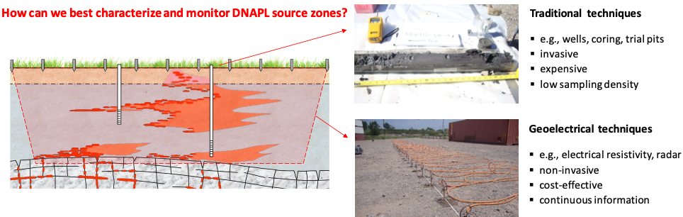
Successful remediation of sites contaminated by dense non-aqueous phase liquids (DNAPLs) requires effective characterization and temporal monitoring strategies. Traditional methods, including monitoring wells and soil corings, are expensive and suffer from low sampling density, providing limited spatial and temporal information. Non-invasive geoelectrical methods, such as electrical resistivity tomography (ERT), induced polarization (IP) and ground penetrating radar (GPR), exhibit significant potential due to the strong electrical contrasts between DNAPL and groundwater. However, geoelectrical methods have not become commonplace at contaminated sites due to the complexity of the DNAPL target and data interpretation.
Effective characterization and monitoring strategies are need at DNAPL-contaminated sites
Program Objectives
The overall objective of this program is to establish geoelectrical techniques as field-proven tools for contaminated site investigations, including sites contaminated with DNAPLs. Specific project objectives include:
- Develop a systematic numerical-based approach for pre-screening and optimizing geoelectrical techniques for field application;
- Assess the relationship between DNAPL and the associated geoelectrical responses; and
- Scale-up geoelectrical techniques for deployment at field sites.
Research Methods
Field Investigations
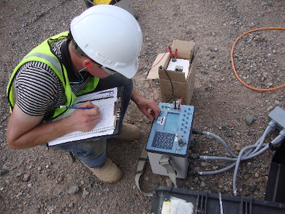
Pilot tests will be performed at industrial field sites as a first step to scale-up geoelectrics for deployment at field sites. Previously, time-lapse ERT was successfully used as a complementary method to monitor the remediation of a coal tar contaminated industrial site by the STAR smouldering technology.
Laboratory experiments
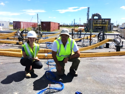
Geophysical characterization and monitoring at a DNAPL-contaminated field site in New Jersey, USA
Click here for more project photos
Multi-dimensional experiments are being performed in flow cells and laboratory tanks to assess the relationship between DNAPL distribution (saturation and geometry in the pore space) and the associated response from ERT, IP and GPR.
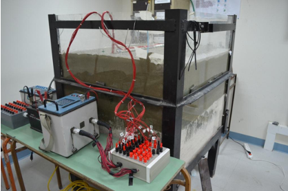
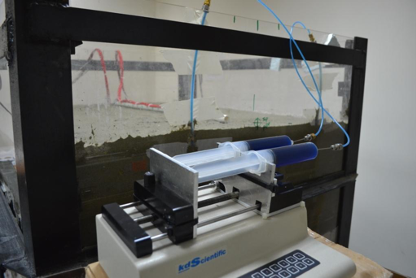
3D laboratory tank experiments with DNAPL migration monitored by time-lapse ERT
Coupled numerical modeling
Novel numerical models are being developed that couple multiphase flow models, which simulate DNAPL migration and remediation, with geoelectrical models, which simulate geoelectrical surveys such as ERT, IP and GPR.
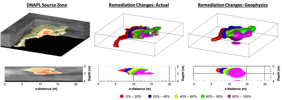
Coupled simulations to assess the performance of time-lapse ERT for monitoring DNAPL remediation
Program Output
Journal Papers (2017 - 2020)
Power, C., Gerhard, J.I., Tsourlos, P., Soupios, P., Simyrdanis, K., Karaoulis, M. (2015) Improved time-lapse electrical resistivity tomography monitoring of dense non-aqueous phase liquids with surface-to-horizontal borehole arrays. Journal of Applied Geophysics, 112, 1-13. doi: 10.1016/j.jappgeo.2014.10.022
Power, C., Gerhard, J.I., Karaoulis, M., Tsourlos, P., Giannopoulos, A. (2014) Evaluating four-dimensional time-lapse electrical resistivity tomography for monitoring DNAPL source zone remediation. Journal of Contaminant Hydrology, 162-163, 27-46. doi: 10.1016/j.jconhyd.2014.04.004
Power, C., Gerhard, J.I., Tsourlos, P., Giannopoulos, A. (2013) A new coupled model for simulating the mapping of dense nonaqueous phase liquids using electrical resistivity tomography. Geophysics, 78 (4), EN1-EN15. doi: 10.1190/GEO2012-0395.1
Wilson, V.C., Power, C., Giannopoulos, A., Gerhard, J.I., Grant, G.P. (2009) DNAPL mapping by ground penetrating radar examined via numerical simulation. Journal of Applied Geophysics, 69 (3-4), 140-149. doi: 10.1016/j.jappgeo.2009.08.006
Selected Conference Publications
Power, C., Trento, L., Tsourlos, P., Gerhard, J.I. (2017) Geoelectrical monitoring of DNAPL remediation. Near Surface Geoscience 2017 – 23rd European Meeting of Environmental and Engineering Geophysics, Workshop (Geophysics for Mapping and Monitoring of Contaminated Ground and Buried Waste), Malmo, Sweden. (Invited)
Power, C., Tsourlos, P., Gerhard, J.I., Dahlin, T. (2017) Novel coupling of contaminant transport and DCIP models for geo-electrical monitoring of contaminant migration: an initial approach.Near Surface Geoscience 2017 – 23rd European Meeting of Environmental and Engineering Geophysics, Malmo, Sweden
Tsourlos, P., Power, C., Gerhard, J.I., Dahlin, T. (2016) Combined ERT and IP modeling for monitoring DNAPLs: preliminary results. Fourth International Workshop on Induced Polarization, Aarhus, Denmark
Power, C., Gerhard, J.I., Tsourlos, P., Soupios, P., Simyrdanis, K., Karaoulis, M. (2015) Geoelectrical monitoring of dense non-aqueous phase liquids with surface-to-horizontal borehole ERT. Proceedings of the Third International Workshop on Geoelectrical Monitoring (GELMON), 24-26 November 2015, Vienna, Austria.
Gerhard, J.I., Power, C., Tsourlos, P., Soupios, P., Karaoulis, M., Simyrdanis, K., Giannopoulos, A. (2014) Mapping contaminant remediation with electrical resistivity tomography. EOS Trans. American Geophysical Union, Fall Meeting, 14-19 December 2014, San Francisco, California, USA, Abstract # H51M-0788. (Invited)
Project Team
Project Leaders:
with
Panos Tsourlos
Project Members:
Maxwell Servos, MESc
Lais Trento, MESc (completed 2017)
Supporting Organizations: